The Batinah plains, Oman's vegetable garden
The Batinah Plain is a coastal strip about 400 kilometres long and about 30 kilometres wide that runs between the western Hadjar Mountains and the Gulf of Oman. It is the vegetable garden of the Sultanate. A multitude of refuge castles and fortresses, like that of Nakhl, protected its inhabitants from raids for centuries.
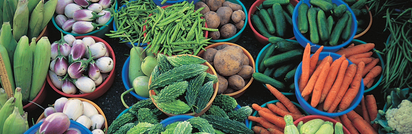
Dates, bananas, limes, mangoes, tomatoes, carrots, aubergines, courgettes, potatoes - all these and many other vegetables are grown on a 270-kilometre-long coastal strip between Muscat and Sohar. Plantation follows plantation, village follows village. A quarter of Oman's population lives here. They largely cover the country's own needs for agricultural products, but of course also consume quite a bit of it themselves. This is why the Omanis like to call the Batina plain the stomach of the country.
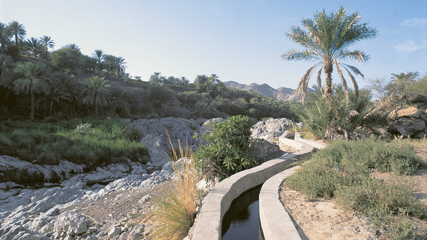
The people owe the water needed for cultivation to the mountains in the west of the plain - the western Hadjar Mountains. The rising humid air masses rain down there and replenish the water table on the coast.
Cultivable land has been scarce in this region since time immemorial and has therefore always been coveted. For centuries, the inhabitants of this coastal strip had to protect themselves against invaders. They built a dense network of simple castles, but also fortifications such as those of Nakhl, Barka, Rostaq, Al Hazm and Sohar, which are still among the most important and worth seeing in the country.
➤ more pictures of the Batinah plains
➤ Hotels in the Batinah region


Contact us for your individual offer
➤ Your contact persons for travel at Arabia Felix:
Maria Popp, Karin Nowack and Georg Popp
✆ Tel.: +49 (0)89 / 30 77 92 00
✉ info@oman.de